
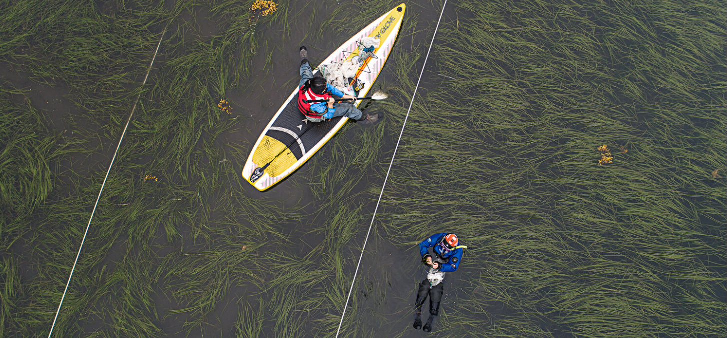
Seagrass meadows stabilize shorelines, filter coastal waters, shelter marine life, and store carbon, yet they are declining in many regions. GeoFly Lab combines low-altitude drone mapping with field ecology and AI-driven image analysis to monitor eelgrass meadows along the Pacific coast of North America, from Alaska to Southern California, with both site-level detail and coast-wide reach.
1. Background
Seagrass meadows are an important component of the global carbon cycle. Through photosynthesis they draw down carbon dioxide and store it in leaves, roots, and the underlying sediments, where it can remain for centuries. Along the U.S. West Coast, eelgrass (Zostera marina) is the dominant species, often accounting for 50 to 90 percent of seagrass cover. It is increasingly threatened by wasting disease, associated with the pathogen Labyrinthula zosterae, which produces dark lesions, loss of green tissue, and in severe cases plant death. Because warming water, nutrient loading, and sedimentation can all raise disease risk, conservation and restoration depend on monitoring that is both rapid and spatially explicit.
2. Origins and collaboration
The drone mapping effort was initiated by Dr. Bo Yang of GeoFly Lab and Dr. Timothy Hawthorne of Auburn University, who share a long-standing interest in making drone mapping accessible to coastal scientists. Their early work developed an introductory drone-mapping training program for seagrass research (Yang et al., 2020), which equipped field teams across the coast to collect consistent, high-resolution imagery with standardized protocols. That shared foundation allowed a regional network of ecologists to add an aerial perspective to long-running field studies.
The project has since grown into a close partnership spanning eight institutions. At Cornell University, Drew Harvell, Lillian Aoki, and Olivia Graham lead the disease ecology, and Carla Gomes contributes expertise in artificial intelligence. Emmett Duffy and Leah Harper of the Smithsonian’s MarineGEO network, and Deanna Beatty and John Stachowicz of UC Davis, connect the surveys to broader studies of coastal ecosystems and eelgrass microbiomes. Regional field programs are led by Ginny Eckert and Lia Domke at the University of Alaska Fairbanks, Margot Hessing-Lewis and Luba Reshitnyk at the Hakai Institute in British Columbia, Fiona Tomas Nash and Ryan Mueller at Oregon State University, and Kevin Hovel at San Diego State University.
3. Study area
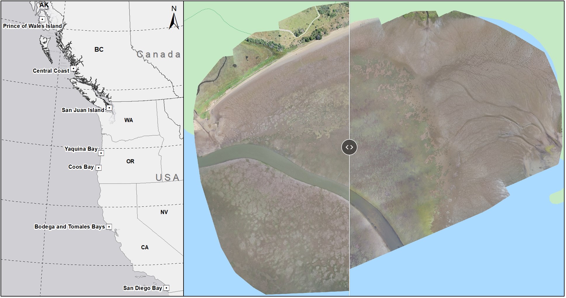
Since 2019, the team has surveyed 33 eelgrass meadows in seven regions spanning roughly 18° of latitude: Prince of Wales Island in Alaska, the Central Coast of British Columbia, the San Juan Islands in Washington, Yaquina Bay and Coos Bay in Oregon, Bodega and Tomales Bays in Northern California, and San Diego and Mission Bays in Southern California. Surveys are timed to summer low tides, and every flight is paired with on-the-ground measurements of eelgrass condition and disease. The resulting archive now holds more than 50,000 drone images and videos.
4. Methods
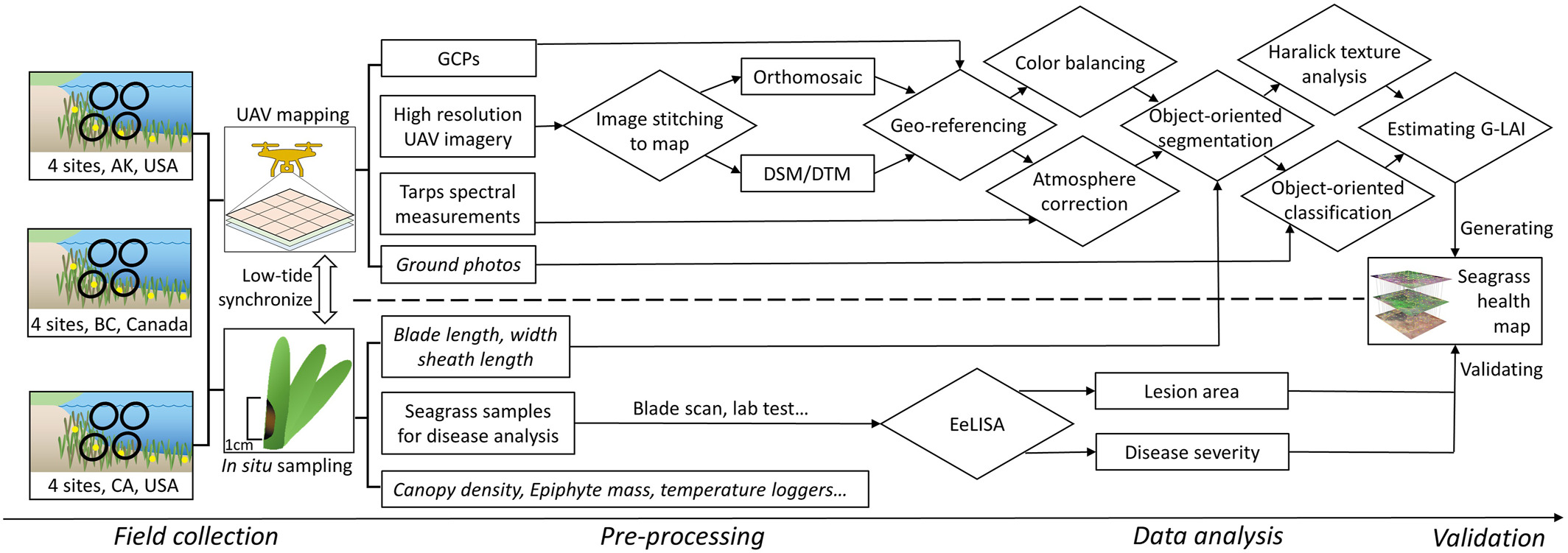
RGB and multispectral imagery are processed into georeferenced orthomosaics using ground control placed both on land and in the water. From these mosaics we derive a Green Leaf Area Index (G-LAI), which quantifies the photosynthetically active eelgrass tissue across entire meadows. To relate imagery to disease, georeferenced eelgrass blades collected in the field are analyzed with EeLISA, an AI-based lesion analysis tool that measures wasting-disease severity and provides ground truth for the remote sensing products. Segmentation workflows built on the Segment Anything Model then separate eelgrass from algae and bare sediment, measure loss of greenness, and track the progression of disease over time.
5. Findings and outcomes
Across the network, low-altitude drone imagery has proven able to quantify eelgrass wasting disease accurately from Alaska to California (Yang et al., 2023). Combined with field surveys and AI-based disease surveillance, the data link disease prevalence to ocean warming across latitudes (Aoki et al., 2022) and show that deeper habitats and cooler temperatures moderate disease (Graham et al., 2023). The work also documents climate-related decline in seagrass meadows (Aoki et al., 2023) and connects landscape-scale patterns to changes in the eelgrass microbiome (Beatty et al., 2021, 2022).
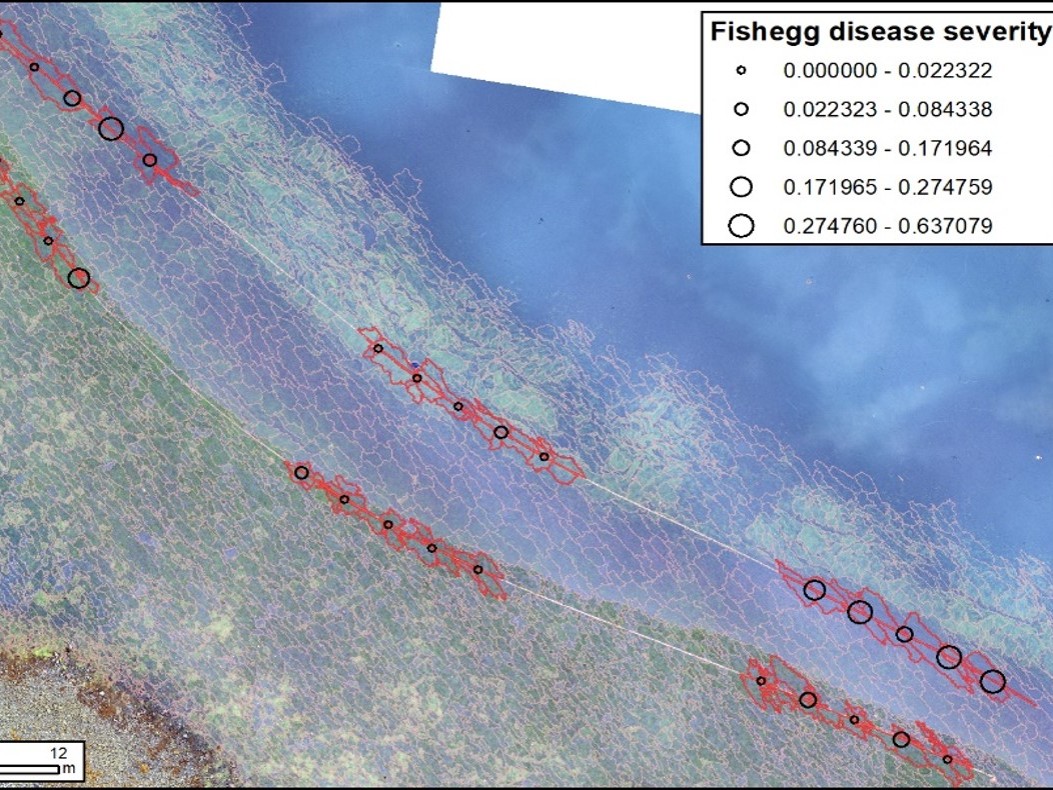
Survey locations, example mosaics, G-LAI layers, and disease-severity products can be explored in interactive story maps. Each one was created and led by students from their own drone mapping field trips along the Pacific coast:
- Student-led field trip (Summer 2025): Drone Mapping Pacific Seagrass Habitats
- Student-led field trip (2026): Drone Mapping Eelgrass Beds of the West Coast
- Student-led field trip (2022): Pacific Coast Seagrass Survey
- Student-led field trip (2021): Eelgrass Wasting Disease and Resilience
Acknowledgment
This work is supported by the National Science Foundation through the Build and Broaden (B2) program. We thank the field teams, students, and community partners at every site who make coast-wide monitoring possible.
Related publications on this project
- Aoki, L.R., Rappazzo, B., Beatty, D.S., Domke, L.K., Eckert, G.L., Eisenlord, M.E., Graham, O.J., Harper, L., Hawthorne, T.L., Hessing-Lewis, M., Hovel, K.A., Yang, B., et al. (2022). Disease surveillance by artificial intelligence links eelgrass wasting disease to ocean warming across latitudes. Limnology and Oceanography. doi:10.1002/lno.12152
- Aoki, L.R., Yang, B., Graham, O.J., Gomes, C., Rappazzo, B., Hawthorne, T.L., Duffy, J.E., & Harvell, D. (2023). UAV high-resolution imaging and disease surveys combine to quantify climate-related decline in seagrass meadows. Oceanography, 36(Supplement 1). doi:10.5670/oceanog.2023.s1.12
- Beatty, D.S., Aoki, L.R., Graham, O.J., & Yang, B. (2021). The future is big—and small: remote sensing enables cross-scale comparisons of microbiome dynamics and ecological consequences. mSystems, 6, e01106-21. doi:10.1128/mSystems.01106-21
- Beatty, D.S., Aoki, L.R., … Yang, B., et al. (2022). Predictable changes in eelgrass microbiomes with increasing wasting disease prevalence across 23° latitude in the northeastern Pacific. mSystems, e00224-22. doi:10.1128/msystems.00224-22
- Graham, O.J., Stephens, T., Rappazzo, B., Klohmann, C., Dayal, S., Adamczyk, E.M., Olson, A., Hessing-Lewis, M., Eisenlord, M., Yang, B., Burge, C., Gomes, C., & Harvell, D. (2023). Deeper habitats and cooler temperatures moderate a climate-driven seagrass disease. Philosophical Transactions of the Royal Society B, 378, 20220016. doi:10.1098/rstb.2022.0016
- Yang, B., Hawthorne, T.L., Aoki, L.R., Beatty, D.S., Domke, L.K., Copeland, T., Eckert, G.L., Graham, O.J., Harper, L., Hessing-Lewis, M., Rappazzo, B., Hovel, K.A., et al. (2023). Low-altitude UAV imaging accurately quantifies eelgrass wasting disease from Alaska to California. Geophysical Research Letters. doi:10.1029/2022GL101985
- Yang, B., Hawthorne, T.L., Hessing-Lewis, M., Duffy, E.J., Reshitnyk, L.Y., Feinman, M., & Searson, H. (2020). Developing an introductory UAV/drone mapping training program for seagrass monitoring and research. Drones, 4, 70. doi:10.3390/drones4040070